%20--%3e%3cg%3e%3cg%20id='Layer_1'%3e%3cg%3e%3cg%3e%3cg%3e%3cg%3e%3cpath%20class='cls-1'%20d='M54.7,12.3c-1.4-1-3.3-1.6-5.5-1.6s-4.1.5-5.5,1.6c-1.7,1.2-2.5,2.9-2.5,5v11.8h5v-11.8c0-.4.1-.7.5-.9.6-.4,1.4-.6,2.6-.6s2,.2,2.6.6c.3.2.4.5.4.9v9.8c0,.5.2,1,.6,1.4.4.4.8.6,1.4.6h3v-11.8c0-2.1-.8-3.7-2.5-5Z'/%3e%3cpath%20class='cls-1'%20d='M75.4,11.1c-1,0-1.9.4-2.5,1.1-1.5-1.1-3.4-1.6-5.5-1.5s-4.4,1.1-6,2.7-2.7,4-2.7,6.5,1,4.9,2.7,6.7,4,2.7,6.6,2.7,3.4-.5,4.8-1.5c.6.7,1.4,1.1,2.5,1.1h1.7V11.1h-1.7ZM71.2,23.2c-.9.9-1.9,1.3-3.2,1.3s-2.3-.5-3.1-1.3-1.2-1.8-1.2-3,.4-2.3,1.2-3.1,1.9-1.3,3.1-1.3,2.2.4,3.1,1.3c.9.9,1.3,1.9,1.3,3.1s-.4,2.2-1.3,3.1h0Z'/%3e%3cpath%20class='cls-1'%20d='M89.5,10.7c-1.5,0-2.8.3-4,1v-6.8h-5v24.1h1.7c1,0,1.9-.4,2.5-1.1,1.5,1.1,3.2,1.6,5.2,1.5s4.7-1.1,6.3-2.8,2.7-4,2.7-6.5-.9-4.8-2.7-6.6c-1.8-1.8-4-2.7-6.6-2.7ZM92.6,23.2c-.9.9-1.9,1.3-3.1,1.3s-2.3-.5-3.1-1.3-1.3-1.9-1.3-3.1.5-2.3,1.3-3.1,1.9-1.3,3.1-1.3,2.3.5,3.1,1.3,1.3,1.9,1.3,3.1-.5,2.3-1.3,3.1Z'/%3e%3cpath%20class='cls-1'%20d='M116.3,11.1c-1,0-1.9.4-2.5,1.1-1.5-1.1-3.4-1.6-5.5-1.5s-4.4,1.1-6,2.7-2.7,4-2.7,6.5,1,4.9,2.7,6.7,4,2.7,6.6,2.7,3.4-.5,4.8-1.5c.6.7,1.4,1.1,2.5,1.1h1.7V11.1h-1.7ZM112.1,23.2c-.9.9-1.9,1.3-3.2,1.3s-2.3-.5-3.1-1.3-1.2-1.8-1.2-3,.4-2.3,1.2-3.1,1.9-1.3,3.1-1.3,2.2.4,3.1,1.3c.9.9,1.3,1.9,1.3,3.1s-.4,2.2-1.3,3.1h0Z'/%3e%3cpath%20class='cls-1'%20d='M157.2,11.1c-1,0-1.9.4-2.5,1.1-1.5-1.1-3.4-1.6-5.5-1.5s-4.4,1.1-6,2.7c-1.8,1.8-2.7,4-2.7,6.5s1,4.9,2.7,6.7,4,2.7,6.6,2.7,3.4-.5,4.8-1.5c.6.7,1.4,1.1,2.5,1.1h1.7V11.1h-1.7ZM153,23.2c-.9.9-1.9,1.3-3.2,1.3s-2.3-.5-3.1-1.3-1.2-1.8-1.2-3,.4-2.3,1.2-3.1,1.9-1.3,3.1-1.3,2.2.4,3.1,1.3c.9.9,1.3,1.9,1.3,3.1s-.4,2.2-1.3,3.1h0Z'/%3e%3cpath%20class='cls-1'%20d='M164.6,10.6c.8,0,1.5-.3,2.1-.9.6-.6.9-1.3.9-2.1s-.3-1.5-.9-2.1c-.6-.6-1.3-.9-2.1-.9s-1.5.3-2.1.9c-.6.6-.9,1.3-.9,2.1s.3,1.5.9,2.1c.6.6,1.3.9,2.1.9Z'/%3e%3c/g%3e%3cpath%20class='cls-1'%20d='M130.2,24c0,0-.2,0-.2.1-.3.2-1.8.3-2.3.3s-1.1-.1-1.4-.4c-.2-.2-.3-.6-.3-1.2v-6.8h2.4c.5,0,1-.2,1.4-.6.4-.4.6-.8.6-1.4v-3h-4.3v-1.6c0-.5-.1-1-.4-1.4-.7-1.1-1.7-1.6-2.8-1.6h-1.7v16.4c0,1.9.6,3.5,1.9,4.7,1.2,1.2,2.8,1.8,4.8,1.8s1.8,0,2.6-.2v-5.3Z'/%3e%3c/g%3e%3crect%20class='cls-1'%20x='162'%20y='11.6'%20width='5'%20height='17.6'/%3e%3cpath%20class='cls-1'%20d='M139.6,26.1c0,1.8-1.5,3.3-3.3,3.3s-2.6-.2-2.8-.2c0,0-.5-2.2-.5-3.1,0-1.8,1.5-3.3,3.3-3.3s2.8.1,3,.4c.2.4.4,2,.4,3Z'/%3e%3c/g%3e%3cpath%20class='cls-1'%20d='M29.3,17.5c-1.9,0-3.5,1.3-3.9,3h-.3c-2.8,0-5.3,1.2-7,3.1v-4.9c0-3.3.5-4.5,3.2-4.6.5,1.6,2,2.7,3.8,2.7s4-1.8,4-4-1.8-4-4-4-3.3,1.2-3.8,2.9c-1.3,0-2.3.3-3.1.7v-4.6c1.6-.5,2.7-2,2.7-3.8S19,.2,16.8.2s-4,1.8-4,4,1.2,3.3,2.9,3.8v4.6c-.8-.5-1.9-.7-3.3-.8-.5-1.7-2-2.9-3.8-2.9s-4,1.8-4,4,1.8,4,4,4,3.2-1.1,3.8-2.7c0,0,0,0,0,0,2.8,0,3.3,1.1,3.3,4.6v4.9c-1.7-1.9-4.2-3.1-7-3.1h-.7c-.4-1.7-2-3-3.9-3S0,19.3,0,21.5s1.8,4,4,4,3.1-1,3.7-2.5h.9c3.9,0,7,3.1,7,7v1.6h-4.2c-.7,0-1.2.5-1.2,1.2s.5,1.2,1.2,1.2h10.9c.7,0,1.2-.5,1.2-1.2s-.5-1.2-1.2-1.2h-4.2v-1.6c0-3.9,3.2-7,7-7h.5c.6,1.5,2,2.5,3.7,2.5s4-1.8,4-4-1.8-4-4-4ZM25,11.4c.9,0,1.6.7,1.6,1.6s-.7,1.6-1.6,1.6-1.6-.7-1.6-1.6.7-1.6,1.6-1.6ZM8.6,14.5c-.9,0-1.6-.7-1.6-1.6s.7-1.6,1.6-1.6,1.6.7,1.6,1.6-.7,1.6-1.6,1.6ZM4.1,23.1c-.9,0-1.6-.7-1.6-1.6s.7-1.6,1.6-1.6,1.6.7,1.6,1.6-.7,1.6-1.6,1.6ZM16.8,5.7c-.9,0-1.6-.7-1.6-1.6s.7-1.6,1.6-1.6,1.6.7,1.6,1.6-.7,1.6-1.6,1.6ZM29.3,23.1s0,0,0,0c0,0,0,0,0,0,0,0-.1,0-.2,0,0,0,0,0,0,0-.8-.1-1.3-.8-1.3-1.5s.6-1.5,1.4-1.6c0,0,0,0,0,0,0,0,0,0,0,0s0,0,0,0c0,0,0,0,0,0,.9,0,1.6.7,1.6,1.6s-.7,1.6-1.6,1.6Z'/%3e%3c/g%3e%3c/g%3e%3c/g%3e%3c/svg%3e)

COP17 has sharpened an operational question about whether biodiversity data can withstand the scrutiny required for public reporting, investment and policy.
The meeting in Yerevan marks the first collective review of progress toward the Kunming-Montreal Global Biodiversity Framework. Governments are assessing action taken since 2022 and preparing for the remaining years to 2030. They are also confronting the quality of the evidence behind their national reports.
The findings suggest that commitment has not yet translated into sufficient progress. Nearly 90 percent of the CBD’s 196 Parties have established national biodiversity targets, but fewer than half of the national targets assessed by Parties are on track. Some parties lack the institutional or technical capacity to apply headline indicators consistently. Negotiating texts therefore distinguish information gaps from gaps in implementation. That distinction matters, although it does not remove the need for stronger monitoring.
For organizations working with ecosystem data, the implication is that biodiversity data must be robust enough to support decisions, which is a higher bar than describing a landscape. Target 3, which calls for at least 30 percent of the world’s land, inland waters, marine areas and coastal areas to be effectively conserved and managed by 2030, shows why better maps alone are not sufficient. Counting protected and conserved areas can demonstrate coverage, but it cannot establish effective management, ecological representation, connectivity or ecosystem condition. Satellite habitat mapping can identify where ecosystems occur, while an ecosystem health assessment, supported by ecosystem health indicators, can examine their condition and reveal change over time. Credible 30x30 reporting therefore requires repeated ecological measurements alongside information about protected boundaries.
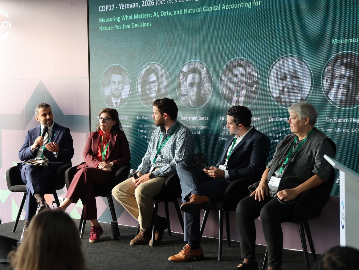
Our COP17 panel, “Measuring What Matters: AI, Data and Natural Capital Accounting for Nature Positive Decisions”, examined how ecological evidence can inform policy, reporting and valuation. Armenia’s first digital ecosystem map provides a foundation for national ecosystem accounting. Yet the discussion also revealed the complexity beneath a national map. Natural vegetation, agricultural land and remnant habitats form intricate mosaics, with rare species sometimes confined to very small areas. Sound ecological assessment methods need to capture that variation without losing sight of the wider landscape.
The Global Ecosystems Atlas and the Data to Action Pavilion demonstrated growing interest in shared data and methods. AI discussions have also matured, addressing governance, energy use and electronic waste alongside possible applications. The next step is to apply equal rigor to validation. AI habitat classification intended for official reporting needs stated accuracy, transparent assumptions and appropriate field checks. Reviewers should be able to trace a reported conclusion back through the model, the source imagery and the observations used to test it.
This is where operational experience becomes relevant. Nabat’s work in Abu Dhabi combined the classification and assessment of 64 habitat types and subtypes with field survey points used to recalibrate model outputs. Our mangrove suitability assessments used 23 environmental indicators to guide drone surveys and targeted field validation. Ether, Nabat’s self-supervised geospatial AI foundation model, supports habitat classification and biomass assessment by drawing together satellite imagery, drone data and field observations. The broader principle is that efficient data collection and scientific verification should be designed as one process.
COP17 has also strengthened the connection between monitoring and finance. Finance ministers are participating in discussions on resources, subsidies and incentives. The International Sustainability Standards Board (ISSB) has opened a consultation on proposed nature-related disclosures. Public and private reporting will not follow identical rules, but both require dependable evidence about particular places. There is an opportunity to reduce duplication by developing site-level data that can serve several legitimate reporting needs.
The same discipline applies to nature-based solutions. Mangroves provide a familiar illustration, with value that may include coastal protection, reduced erosion, support for fisheries and carbon sequestration. Understanding these benefits of nature-based solutions requires evidence about ecosystem extent, condition and change before financial values are assigned. Natural capital accounting is stronger when it begins with observed ecological conditions rather than broad assumptions.
The approach taken now will shape the next reporting cycle. Parties’ eighth national reports are due by 30 June 2029 and will feed into the second global review of the Framework at COP19 in 2030. Replicability must therefore be built into current programs. Teams need consistent methods, documented uncertainty and validation locations that can be revisited. Without those provisions, a new dataset may not establish whether anything has changed.
Before the 2029 reporting cycle, governments, businesses and conservation organizations should make independent verification a standard part of biodiversity monitoring. This means publishing methodologies, preserving baseline records and funding the fieldwork needed to test model outputs. The next global assessment should rest on evidence that reviewers can examine and reproduce.