








Full-GCC coastline coverage
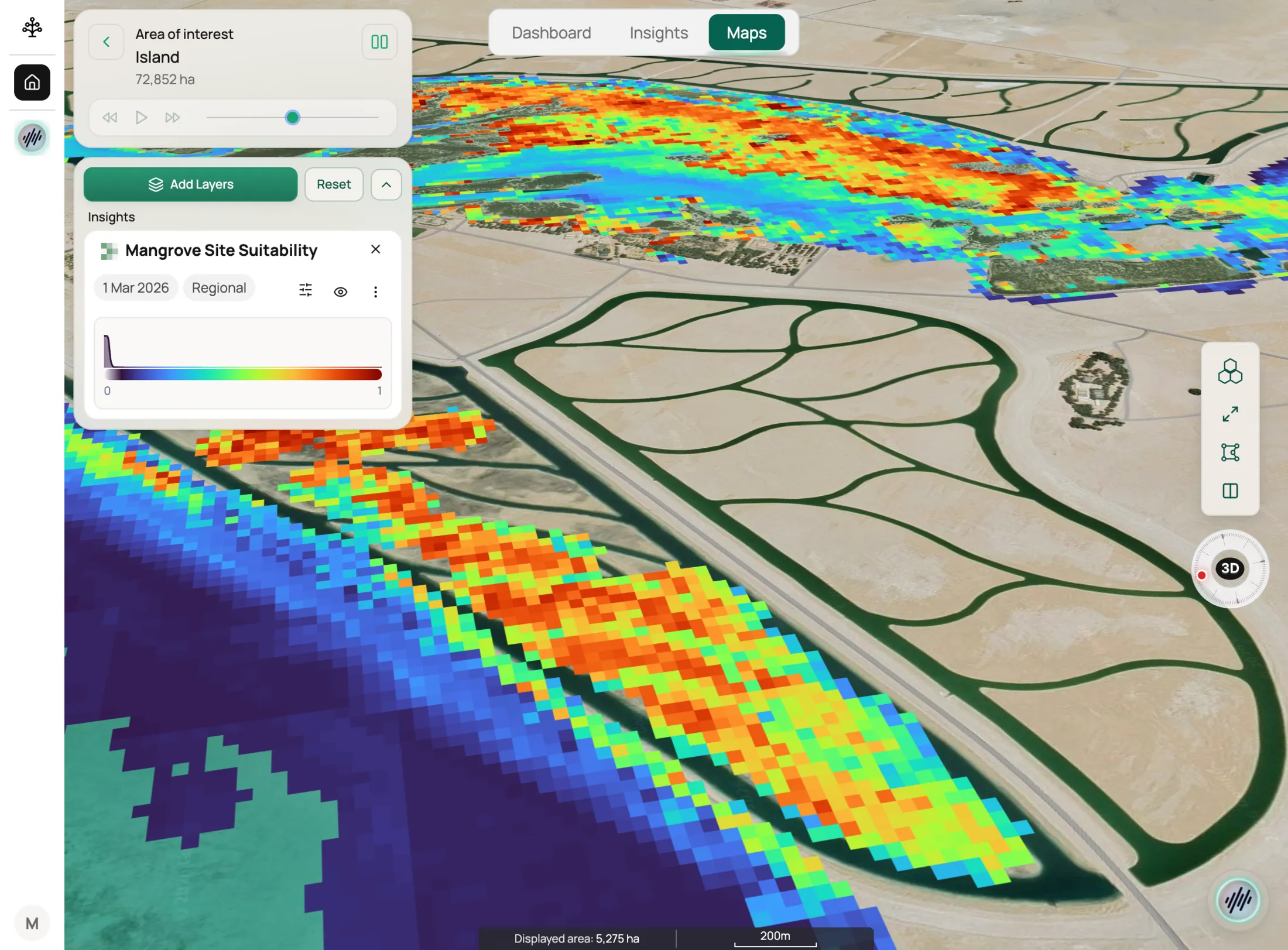
Score every point across your entire coastline, rather than a sample of it.
%20--%3e%3cg%3e%3cg%20id='Layer_1'%3e%3cg%3e%3cg%3e%3cg%3e%3cg%3e%3cpath%20class='cls-1'%20d='M54.7,12.3c-1.4-1-3.3-1.6-5.5-1.6s-4.1.5-5.5,1.6c-1.7,1.2-2.5,2.9-2.5,5v11.8h5v-11.8c0-.4.1-.7.5-.9.6-.4,1.4-.6,2.6-.6s2,.2,2.6.6c.3.2.4.5.4.9v9.8c0,.5.2,1,.6,1.4.4.4.8.6,1.4.6h3v-11.8c0-2.1-.8-3.7-2.5-5Z'/%3e%3cpath%20class='cls-1'%20d='M75.4,11.1c-1,0-1.9.4-2.5,1.1-1.5-1.1-3.4-1.6-5.5-1.5s-4.4,1.1-6,2.7-2.7,4-2.7,6.5,1,4.9,2.7,6.7,4,2.7,6.6,2.7,3.4-.5,4.8-1.5c.6.7,1.4,1.1,2.5,1.1h1.7V11.1h-1.7ZM71.2,23.2c-.9.9-1.9,1.3-3.2,1.3s-2.3-.5-3.1-1.3-1.2-1.8-1.2-3,.4-2.3,1.2-3.1,1.9-1.3,3.1-1.3,2.2.4,3.1,1.3c.9.9,1.3,1.9,1.3,3.1s-.4,2.2-1.3,3.1h0Z'/%3e%3cpath%20class='cls-1'%20d='M89.5,10.7c-1.5,0-2.8.3-4,1v-6.8h-5v24.1h1.7c1,0,1.9-.4,2.5-1.1,1.5,1.1,3.2,1.6,5.2,1.5s4.7-1.1,6.3-2.8,2.7-4,2.7-6.5-.9-4.8-2.7-6.6c-1.8-1.8-4-2.7-6.6-2.7ZM92.6,23.2c-.9.9-1.9,1.3-3.1,1.3s-2.3-.5-3.1-1.3-1.3-1.9-1.3-3.1.5-2.3,1.3-3.1,1.9-1.3,3.1-1.3,2.3.5,3.1,1.3,1.3,1.9,1.3,3.1-.5,2.3-1.3,3.1Z'/%3e%3cpath%20class='cls-1'%20d='M116.3,11.1c-1,0-1.9.4-2.5,1.1-1.5-1.1-3.4-1.6-5.5-1.5s-4.4,1.1-6,2.7-2.7,4-2.7,6.5,1,4.9,2.7,6.7,4,2.7,6.6,2.7,3.4-.5,4.8-1.5c.6.7,1.4,1.1,2.5,1.1h1.7V11.1h-1.7ZM112.1,23.2c-.9.9-1.9,1.3-3.2,1.3s-2.3-.5-3.1-1.3-1.2-1.8-1.2-3,.4-2.3,1.2-3.1,1.9-1.3,3.1-1.3,2.2.4,3.1,1.3c.9.9,1.3,1.9,1.3,3.1s-.4,2.2-1.3,3.1h0Z'/%3e%3cpath%20class='cls-1'%20d='M157.2,11.1c-1,0-1.9.4-2.5,1.1-1.5-1.1-3.4-1.6-5.5-1.5s-4.4,1.1-6,2.7c-1.8,1.8-2.7,4-2.7,6.5s1,4.9,2.7,6.7,4,2.7,6.6,2.7,3.4-.5,4.8-1.5c.6.7,1.4,1.1,2.5,1.1h1.7V11.1h-1.7ZM153,23.2c-.9.9-1.9,1.3-3.2,1.3s-2.3-.5-3.1-1.3-1.2-1.8-1.2-3,.4-2.3,1.2-3.1,1.9-1.3,3.1-1.3,2.2.4,3.1,1.3c.9.9,1.3,1.9,1.3,3.1s-.4,2.2-1.3,3.1h0Z'/%3e%3cpath%20class='cls-1'%20d='M164.6,10.6c.8,0,1.5-.3,2.1-.9.6-.6.9-1.3.9-2.1s-.3-1.5-.9-2.1c-.6-.6-1.3-.9-2.1-.9s-1.5.3-2.1.9c-.6.6-.9,1.3-.9,2.1s.3,1.5.9,2.1c.6.6,1.3.9,2.1.9Z'/%3e%3c/g%3e%3cpath%20class='cls-1'%20d='M130.2,24c0,0-.2,0-.2.1-.3.2-1.8.3-2.3.3s-1.1-.1-1.4-.4c-.2-.2-.3-.6-.3-1.2v-6.8h2.4c.5,0,1-.2,1.4-.6.4-.4.6-.8.6-1.4v-3h-4.3v-1.6c0-.5-.1-1-.4-1.4-.7-1.1-1.7-1.6-2.8-1.6h-1.7v16.4c0,1.9.6,3.5,1.9,4.7,1.2,1.2,2.8,1.8,4.8,1.8s1.8,0,2.6-.2v-5.3Z'/%3e%3c/g%3e%3crect%20class='cls-1'%20x='162'%20y='11.6'%20width='5'%20height='17.6'/%3e%3cpath%20class='cls-1'%20d='M139.6,26.1c0,1.8-1.5,3.3-3.3,3.3s-2.6-.2-2.8-.2c0,0-.5-2.2-.5-3.1,0-1.8,1.5-3.3,3.3-3.3s2.8.1,3,.4c.2.4.4,2,.4,3Z'/%3e%3c/g%3e%3cpath%20class='cls-1'%20d='M29.3,17.5c-1.9,0-3.5,1.3-3.9,3h-.3c-2.8,0-5.3,1.2-7,3.1v-4.9c0-3.3.5-4.5,3.2-4.6.5,1.6,2,2.7,3.8,2.7s4-1.8,4-4-1.8-4-4-4-3.3,1.2-3.8,2.9c-1.3,0-2.3.3-3.1.7v-4.6c1.6-.5,2.7-2,2.7-3.8S19,.2,16.8.2s-4,1.8-4,4,1.2,3.3,2.9,3.8v4.6c-.8-.5-1.9-.7-3.3-.8-.5-1.7-2-2.9-3.8-2.9s-4,1.8-4,4,1.8,4,4,4,3.2-1.1,3.8-2.7c0,0,0,0,0,0,2.8,0,3.3,1.1,3.3,4.6v4.9c-1.7-1.9-4.2-3.1-7-3.1h-.7c-.4-1.7-2-3-3.9-3S0,19.3,0,21.5s1.8,4,4,4,3.1-1,3.7-2.5h.9c3.9,0,7,3.1,7,7v1.6h-4.2c-.7,0-1.2.5-1.2,1.2s.5,1.2,1.2,1.2h10.9c.7,0,1.2-.5,1.2-1.2s-.5-1.2-1.2-1.2h-4.2v-1.6c0-3.9,3.2-7,7-7h.5c.6,1.5,2,2.5,3.7,2.5s4-1.8,4-4-1.8-4-4-4ZM25,11.4c.9,0,1.6.7,1.6,1.6s-.7,1.6-1.6,1.6-1.6-.7-1.6-1.6.7-1.6,1.6-1.6ZM8.6,14.5c-.9,0-1.6-.7-1.6-1.6s.7-1.6,1.6-1.6,1.6.7,1.6,1.6-.7,1.6-1.6,1.6ZM4.1,23.1c-.9,0-1.6-.7-1.6-1.6s.7-1.6,1.6-1.6,1.6.7,1.6,1.6-.7,1.6-1.6,1.6ZM16.8,5.7c-.9,0-1.6-.7-1.6-1.6s.7-1.6,1.6-1.6,1.6.7,1.6,1.6-.7,1.6-1.6,1.6ZM29.3,23.1s0,0,0,0c0,0,0,0,0,0,0,0-.1,0-.2,0,0,0,0,0,0,0-.8-.1-1.3-.8-1.3-1.5s.6-1.5,1.4-1.6c0,0,0,0,0,0,0,0,0,0,0,0s0,0,0,0c0,0,0,0,0,0,.9,0,1.6.7,1.6,1.6s-.7,1.6-1.6,1.6Z'/%3e%3c/g%3e%3c/g%3e%3c/g%3e%3c/svg%3e)
See exactly where restoration will work, and where it won't.
Score every point across your entire coastline, rather than a sample of it.

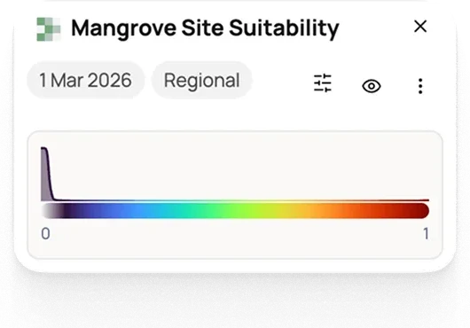
Rank sites against each other with a 0–100% score, not a pass/fail cutoff — 100% marks the strongest restoration potential.

Know exactly where to focus before any drones or field teams are deployed.

20+ environmental predictors behind every score, built to hold up under scrutiny.
See exactly where restoration will work, and where it won't.
Share your details and get instant access to Restoration Planner on NabatOS.

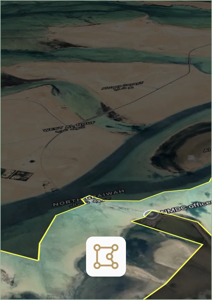
Draw your coastal area of interest directly on the map and let NabatOS assess its restoration potential.
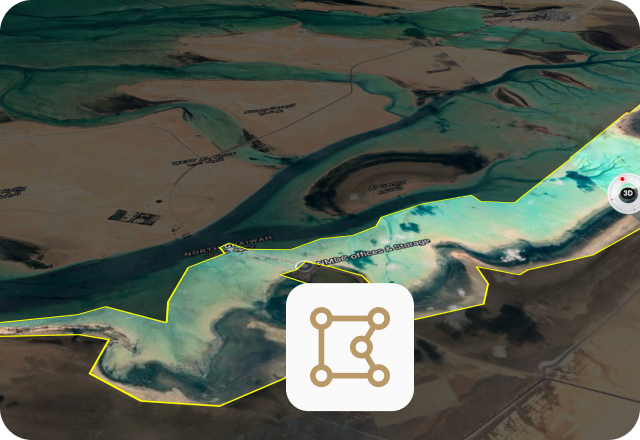
See your suitability score and the key factors behind it, helping you understand where to focus.
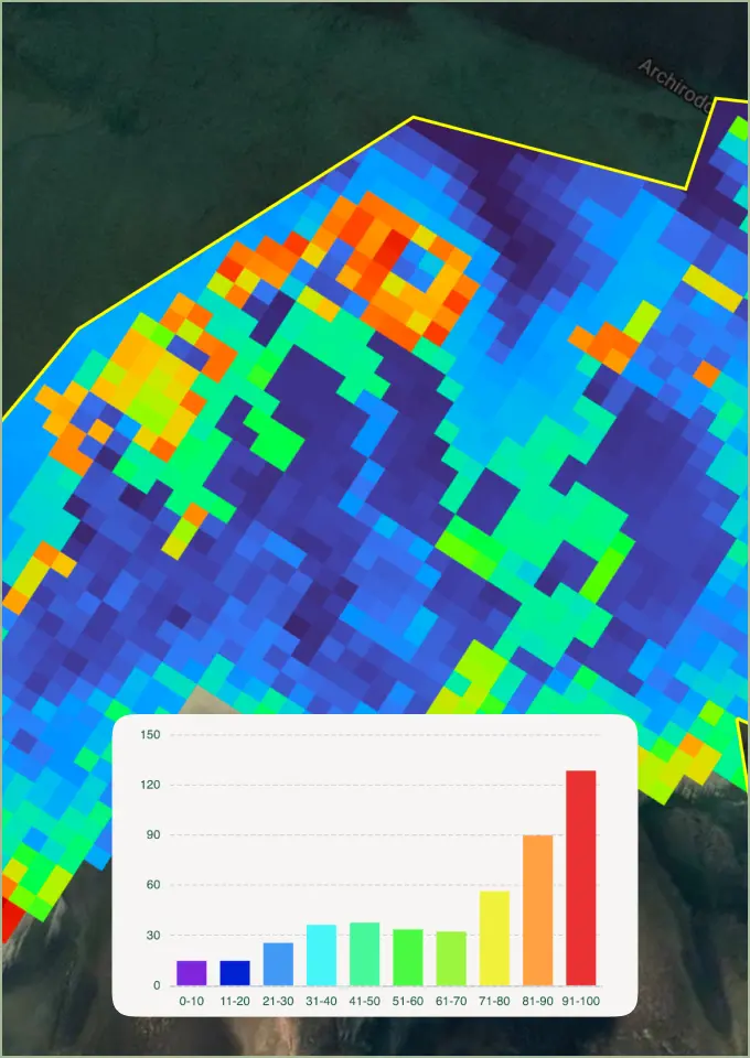
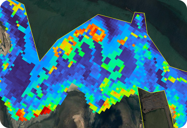
Watch how NabatOS helps you assess site suitability, understand the factors behind the score and identify where to focus.
No credit card required
Full access to Stage 1 - with a clear path to Stages 2 and 3 when you're ready to go further.
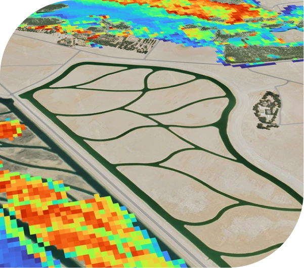
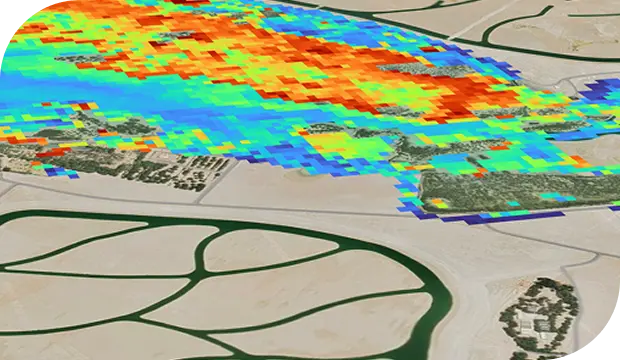
See the restoration potential across your entire region
Satellite-derived identification of high potential areas
We screen your entire region of interest from space and give every point a restoration potential score from 0% to 100%. The score is built from 5–10 years of satellite imagery and scientific datasets and uses a research-backed AI model that considers 23 different environmental predictors of mangrove suitability.
No credit card required
No credit card required
From candidate areas to sites
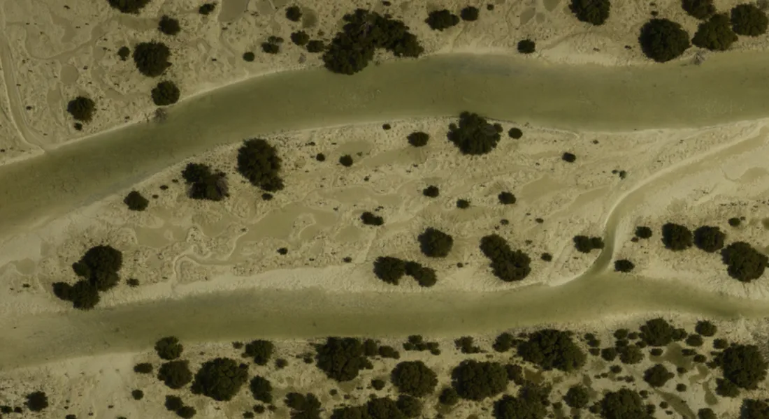
Using high resolution satellite imagery (down to 30x30cm GSD), our proprietary land cover and habitat classification AI models, and tidal regime and wave exposure analysis, we identify the exact sites available and suitable for planting and seeding, as well as reference and donor sites.
Output: High res RGB & MSP orthomosaics, land cover and habitat maps, full site analysis report
Final site selection and field validation
Combination of ultra-high resolution drone and field surveys that confirm soil, water, environmental conditions match what’s been modeled. All outputs reviewed by our in-house ecology team. A report that tells you which areas you can confidently restore, the baseline conditions, and how to monitor the outcomes.
Output: Ecology-validated seeding and planting polygons, final restoration management and monitoring report.

Get in touch to get access to the full product
Get access to the full product
Nabat's research-backed 3-stage site selection methodology is what's been missing to scale up mangrove restoration in the region. It brings together the best of ecological science, geospatial AI, and remote sensing into a single tool not available anywhere else
 Nada El Shanawany
Senior Ecology Manager
Have questions about our methodology, scoring algorithm, or the demo?
You get access to the full Stage 1 of Restoration Planner in NabatOS. You define your area of interest, and Restoration Planner scores every point across it from 0 to 100%, with the underlying maps and layers available and KML export for your areas of interest.
Send us a message and get access to more features.
Contact us