Multi-sensor data acquisition via survey drones, satellites, field sensors, LiDAR, SAR, and optical imagery at millimeter resolution
We work with governments, developers, and conservation partners across the full restoration lifecycle. From baseline data capture and ecological planning through to autonomous restoration and long-term monitoring, Nabat provides the infrastructure that nature programs need to perform at scale.
Contact Us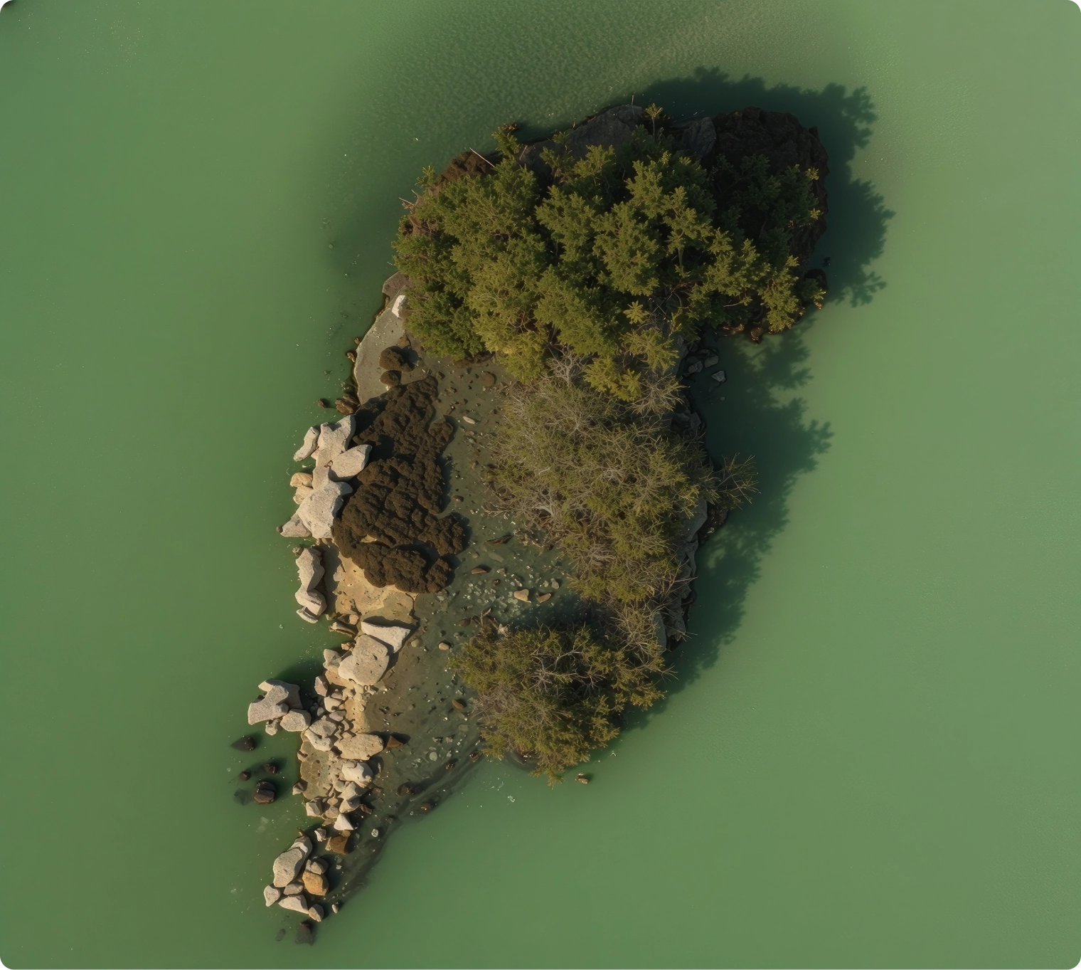
Meet Nabat
at MIITE 2026.
Nabat develops science-led solutions for the assessment, planning, restoration, and monitoring of ecosystems - from coastlines and dryland habitats to marine environments. Our two products, NabatOS and Nabat Restoration, work together to take a nature program from raw data to verified outcomes.
Our
Products
— 01
NabatOS
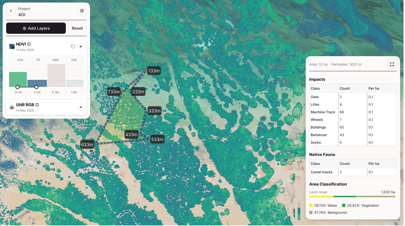
NabatOS is our core platform - the intelligence layer that turns satellite, aerial, and field data into decision-grade, verifiable ecosystem outcomes. Powered by Ether, our proprietary geospatial AI model trained on exclusive coastal and dryland datasets, NabatOS manages the full six-stage pipeline:
Analyze ecological health, habitat condition, species presence, and restoration constraints using AI-assisted geospatial models.
Turn assessment outputs into restoration plans, intervention zones, timelines, and measurable success criteria.
Coordinate restoration delivery across teams, autonomous systems, field operators, and project stakeholders.
Track ecological change over time with repeat surveys, field observations, and automated reporting workflows.
Generate evidence-backed outcomes that can support reporting, assurance, and long-term nature program governance.
— 02
Nabat
Restoration
Nabat Restoration is our delivery arm - the services and autonomous systems that execute what NabatOS plans. It brings together the full range of capabilities required to take a restoration program from site assessment to verified impact:
Plan, resource, and deliver nature programs from early feasibility through field execution and reporting.
Capture restoration-grade data through drones, sensors, field teams, and remote sensing workflows.
Use autonomous aerial systems to seed selected restoration zones with precision and repeatability.
Support site selection, ecological baselines, intervention design, and science-led program governance.
Bring local partners, communities, and stakeholders into the program with clear participation pathways.
03 / Partnership
Partnering
for impact
At Nabat, we believe meaningful partnerships turn innovation into action - restoring ecosystems at scale.
We work closely with the Environment Agency - Abu Dhabi as part of the Abu Dhabi Mangrove Initiative, supporting the UAE's goal to plant 100 million mangroves by 2030.
Scalable impact
Watch how Nabat's
autonomous systems
restore ecosystems at scale.
Learn about Nabat
Mangrove conservation and
restoration in the UAE
Let's connect
We'd love to hear from you. Leave your details and we'll be in touch.